JK1SXR
Snapshot 61 No.610-619
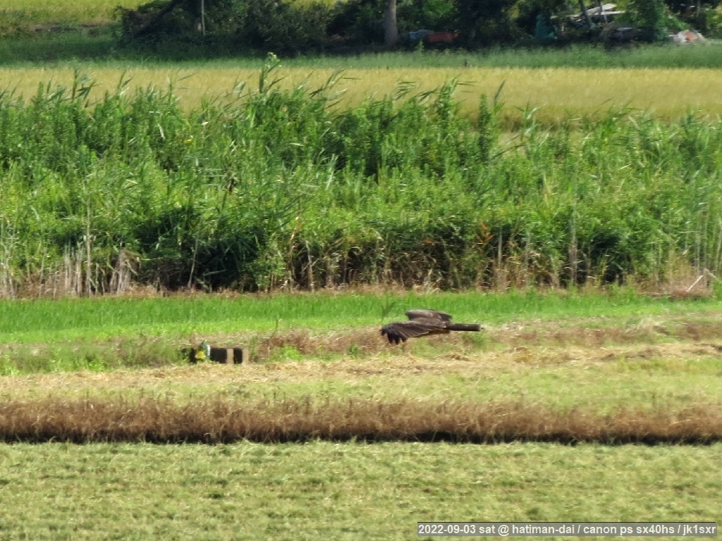
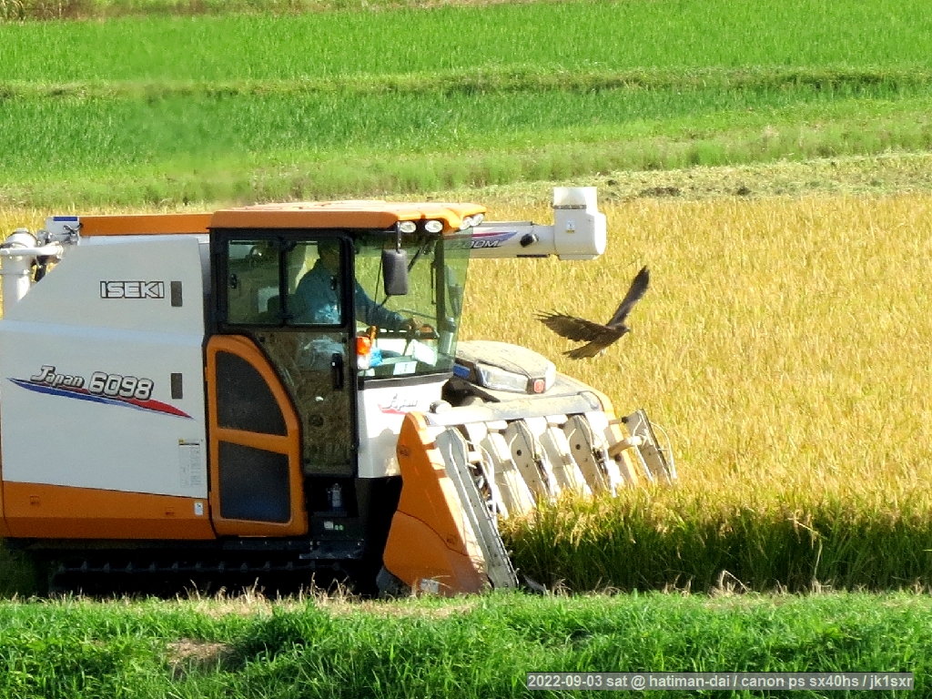
619. A harvesting and a hunting
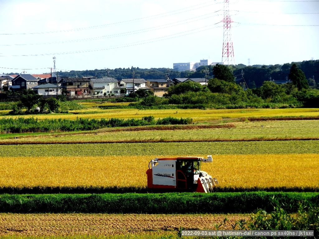 Rice harvesting has started.
No one was seen, other than this machine and a truck to load the harvest.
Exception were 2 kites.
Preys seem to come out, and the two chased the moving machine and repeated low-altitude flights.
618. Apples and intellectual property rights
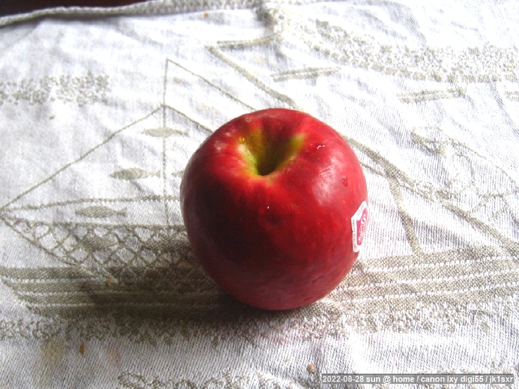 An apple from New Zealand, "Pink Lady". The apple from the same country taken up here before is "Jazz". Both are small and a bit sour.
The "Pink Lady" breed was originally developed in Australia.
Both breeds are protected by intellectual property rights. Unless one becomes a club member, the production and sales are not allowed.
Utilizing intellectual property rights is not limited to industrial fields in these days.
617. A tukutuku-bousi
 A dead tukutuku-bousi which had lain on the ground at a nearby square.
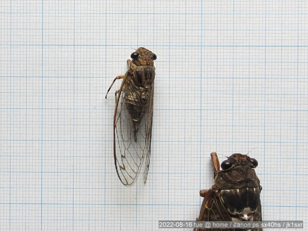
Dead cicadas all lie on the ground with their bellies up, even if their center of gravity look to be at the belly side.
P/S:
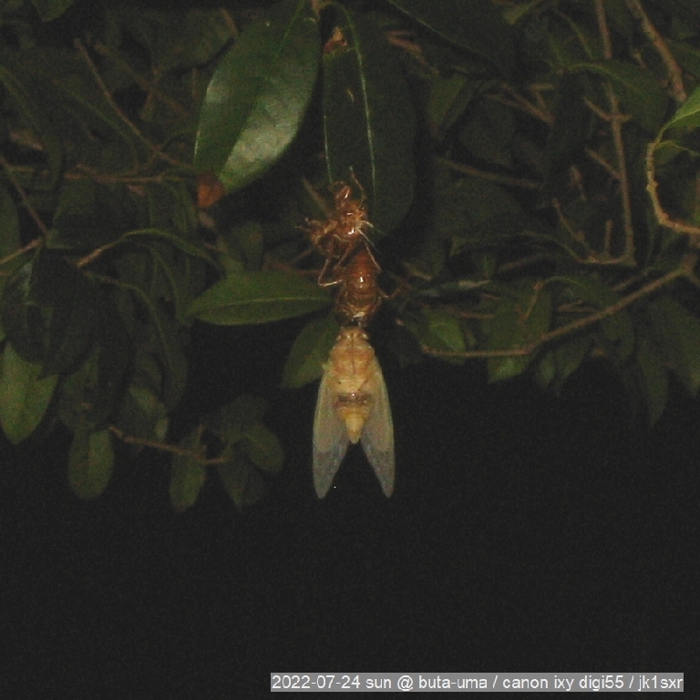
 The right is a shot a tukutuku-bousi had just emerged from its shell at the same square.
Though it could be a look-alike higurasi.
616. O-tuki-san
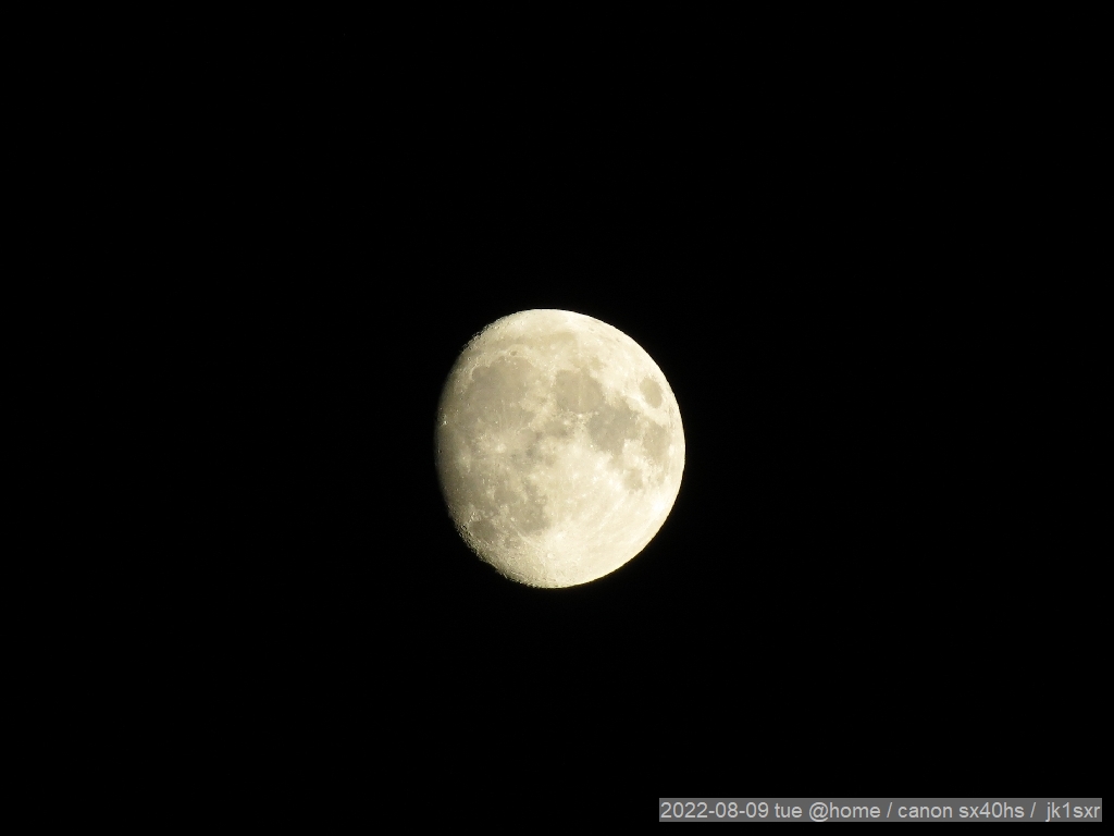 Today's o-tuki-san. The moon-phase is 11.4.
A Rugby-ball shape.
One among the hand-held several shots.
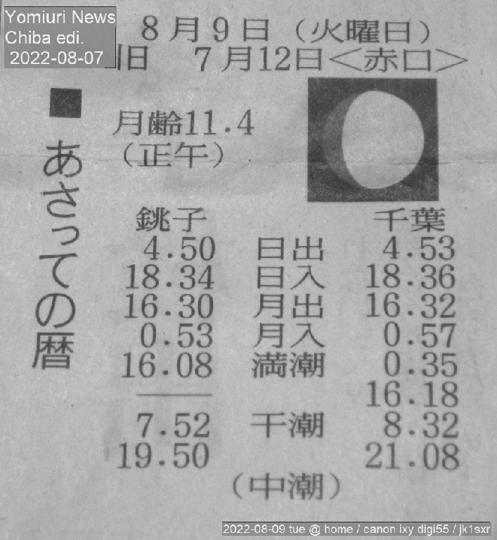
Acc. to the calendar on the newspaper, today August 9th corresponds to
the July 12th based on the old lunisolar calendar.
615. Kabuto-musi
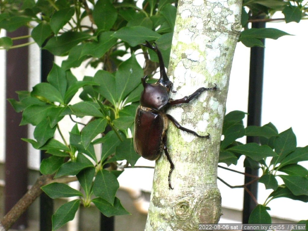 This summer too, kabuto-musis have come. This one is from an adjacent square and placed to an applicot at my place.
Probably because the ko-nara trees in the square got larger and increasingly secrete the sap, the number of the kabuto-musi' appearance looks increasing year by year.
614. Futa-mata mountain
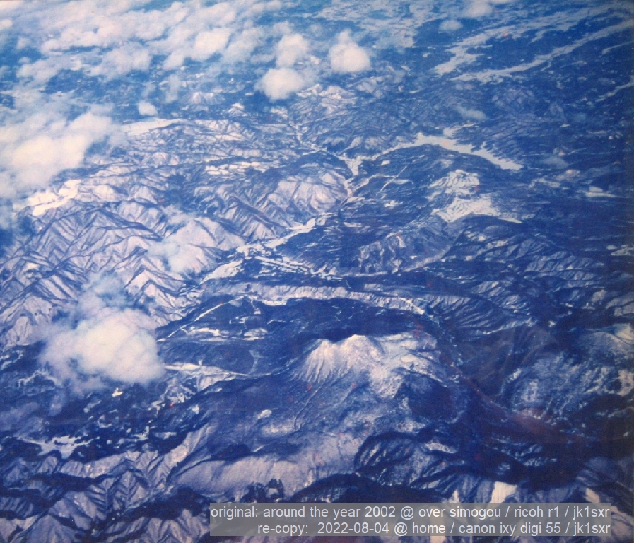 During the junk sorting, a framed photo appeared, and I took this picture as it is from the front.
A mountain called Futa-mata-yama is seen in the photo. The twin peaks in the middle is the mountain.
This covers Ten-ei village including the mountain and Hatori-lake.
For years, I had wondered what were the two white lines like the horns of a stag beetle extending obliquely downward from the right upper corner of the top photo.
As the photo again appeared, I tried to check this point again.
Now, satellite images and all others can be obtained instantly.
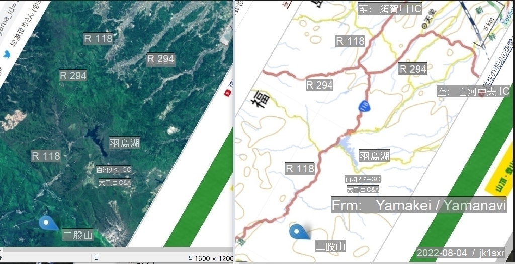 As a trial I borrowed "Yama-kei" site data, and and applied such modifications as aligning the direction and the size to those of the picture.
Shown at the right is the result, the satellite image and the map are placed side by side.
All became clear at a glance. The two white lines are the open areas along the National Routes 118 and 294. Seen from above, such areas are to look white.
After the 20 years, the question was finally solved.
Below is an additional account about this photo.
= = = = =
About 20 years ago, distributed power supply system was booming, and I went to Germany for the introduction of a digital control system enabling the engine-generators to be fully automatically operated by linking to the power grids. The photo was taken on my way back at that occasion.
The camera was of a pocket-type with a 24 mm wide-angle lens / Ricoh R1. Although it was a fully-automated camera from film loading to rewinding, it could manually set the focus to the infinity distance. As this function eliminates the required time for the auto-focusing, it enhanced the snapshot capability.
Initially I took this shot believing that this is the Mt. "Hiuti-ga-take" at Oze.
When we are in Oze, we notice that it is under an aviation route. So, I had wanted to take an aerial photo, if and when the chance comes. Further I had simply thought that the volcano with two peaks is the Mt. "Hiuti".
These combined to create my wrong assumption.
Checking the surrounding ridges in the print immediately showed that it was not the "Hiuti".
Then, where the mountain is situated?
First of all, the usual return route from the Siberia is via Niigata - Daigo VOR - Kasima Sea.
After a week of checking several maps every nights, I finally came to arrive to this "Futa-mata-yama" (twin-peak mountain) exactly under that route.
Mt. "Hiuti" is located 40 km west of this air-route and its hight exceeds well 2,300 m, While that of the Mt. "Futamata" is 1,500 m. In terms of the mountain size, they are considerabley different.
= = = = =
Now this time, I realized that the areas along the National Routes 118 and 294 had looked in white.
613. A hime-hanmyou?
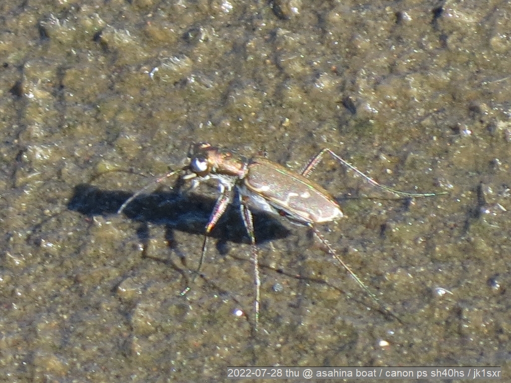
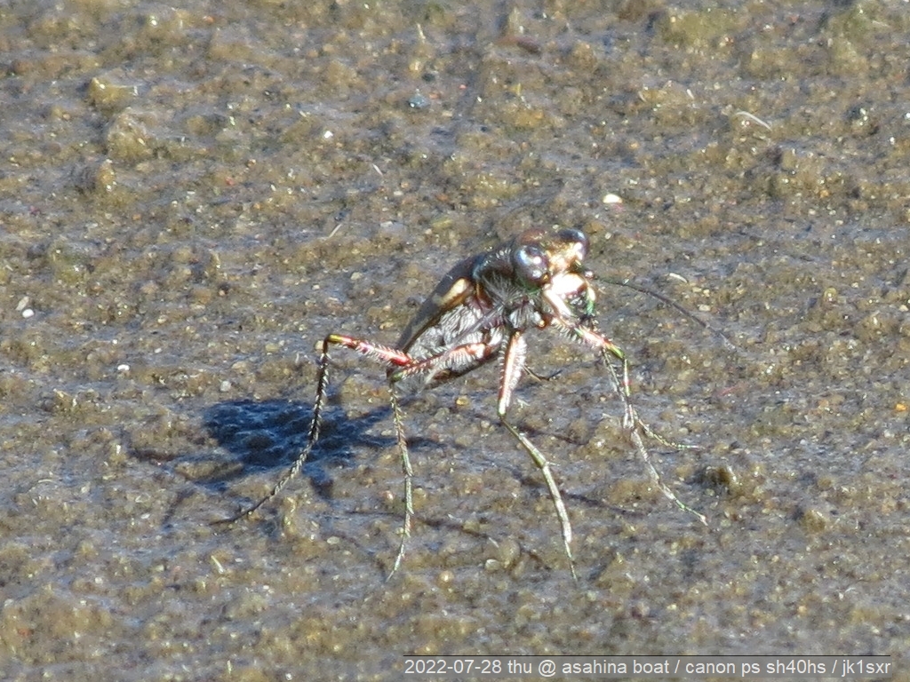
A hanmyou seen in front of "A. Boat" at Inba marsh.
Its shape and movement instantly indicate a hanmyou family. But the size is much smaller, less than a half of the colorful hanmyou (nami-hanmyou) seen at a mountain path.
Considering the length (1 cm) and the back pattern, it looks to be "hime-hanmyou" or "eliza-hanmyo".
The "eliza" sounds unfamiliar. It is said that the first finder of this insect is a Russian (the first consul at Hakodate) and he adopted his wife's name.
612. A pumpkin-like red clothes!?
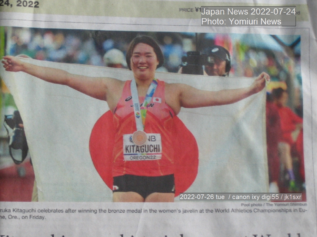 The photo is from Japan News.
It shows a person in an athletic game. Her unifom looks very strange.
A large-pumpkin-like bright red clothes!?
It was so strange, the following day, I asked XYL about if those who did well in the javelin competition wear this type of clothes.
The answer was an oracle; "Never Seen Nor Heard".
Driven to be at a loss, I further looked at the picture for any clue.
Well, she looks grabbing something.
Further look at the grabbed thing showed that it is the national flag.
In essence, the fact is only that;
she wears a red uniform and spreads the hinomaru flag on her back.
Oh my Buddha, I do not want to get aged.
611. Weather: Fine
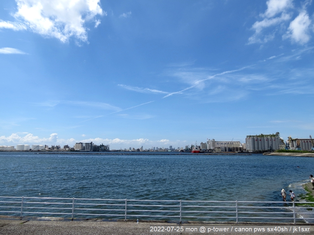
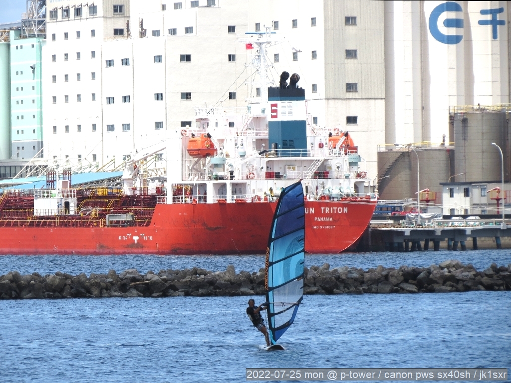
The sea in front of the Chiba Port Tower this noon time.
The temp., humidity and wind are all mild.
610. An abura-zemi
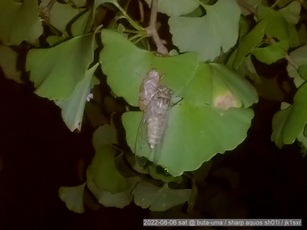
 At this time of year, around 10 in the evening, a carefull look at the trees enables us to find this type of critters hanging here and there. At a nearby square.
Though its coloring is not yet fully changed, it must be an abura-zemi.
619. A harvesting and a hunting
Rice harvesting has started.No one was seen, other than this machine and a truck to load the harvest.
Exception were 2 kites.
Preys seem to come out, and the two chased the moving machine and repeated low-altitude flights.
618. Apples and intellectual property rights
An apple from New Zealand, "Pink Lady". The apple from the same country taken up here before is "Jazz". Both are small and a bit sour.The "Pink Lady" breed was originally developed in Australia.
Both breeds are protected by intellectual property rights. Unless one becomes a club member, the production and sales are not allowed.
Utilizing intellectual property rights is not limited to industrial fields in these days.
617. A tukutuku-bousi
A dead tukutuku-bousi which had lain on the ground at a nearby square.Dead cicadas all lie on the ground with their bellies up, even if their center of gravity look to be at the belly side.
P/S:
The right is a shot a tukutuku-bousi had just emerged from its shell at the same square.Though it could be a look-alike higurasi.
616. O-tuki-san
Today's o-tuki-san. The moon-phase is 11.4.A Rugby-ball shape.
One among the hand-held several shots.
Acc. to the calendar on the newspaper, today August 9th corresponds to
the July 12th based on the old lunisolar calendar.
615. Kabuto-musi
This summer too, kabuto-musis have come. This one is from an adjacent square and placed to an applicot at my place.Probably because the ko-nara trees in the square got larger and increasingly secrete the sap, the number of the kabuto-musi' appearance looks increasing year by year.
614. Futa-mata mountain
During the junk sorting, a framed photo appeared, and I took this picture as it is from the front.A mountain called Futa-mata-yama is seen in the photo. The twin peaks in the middle is the mountain.
This covers Ten-ei village including the mountain and Hatori-lake.
For years, I had wondered what were the two white lines like the horns of a stag beetle extending obliquely downward from the right upper corner of the top photo.
As the photo again appeared, I tried to check this point again.
Now, satellite images and all others can be obtained instantly.
As a trial I borrowed "Yama-kei" site data, and and applied such modifications as aligning the direction and the size to those of the picture.Shown at the right is the result, the satellite image and the map are placed side by side.
All became clear at a glance. The two white lines are the open areas along the National Routes 118 and 294. Seen from above, such areas are to look white.
After the 20 years, the question was finally solved.
Below is an additional account about this photo.
= = = = =
About 20 years ago, distributed power supply system was booming, and I went to Germany for the introduction of a digital control system enabling the engine-generators to be fully automatically operated by linking to the power grids. The photo was taken on my way back at that occasion.
The camera was of a pocket-type with a 24 mm wide-angle lens / Ricoh R1. Although it was a fully-automated camera from film loading to rewinding, it could manually set the focus to the infinity distance. As this function eliminates the required time for the auto-focusing, it enhanced the snapshot capability.
Initially I took this shot believing that this is the Mt. "Hiuti-ga-take" at Oze.
When we are in Oze, we notice that it is under an aviation route. So, I had wanted to take an aerial photo, if and when the chance comes. Further I had simply thought that the volcano with two peaks is the Mt. "Hiuti".
These combined to create my wrong assumption.
Checking the surrounding ridges in the print immediately showed that it was not the "Hiuti".
Then, where the mountain is situated?
First of all, the usual return route from the Siberia is via Niigata - Daigo VOR - Kasima Sea.
After a week of checking several maps every nights, I finally came to arrive to this "Futa-mata-yama" (twin-peak mountain) exactly under that route.
Mt. "Hiuti" is located 40 km west of this air-route and its hight exceeds well 2,300 m, While that of the Mt. "Futamata" is 1,500 m. In terms of the mountain size, they are considerabley different.
= = = = =
Now this time, I realized that the areas along the National Routes 118 and 294 had looked in white.
613. A hime-hanmyou?
A hanmyou seen in front of "A. Boat" at Inba marsh.
Its shape and movement instantly indicate a hanmyou family. But the size is much smaller, less than a half of the colorful hanmyou (nami-hanmyou) seen at a mountain path.
Considering the length (1 cm) and the back pattern, it looks to be "hime-hanmyou" or "eliza-hanmyo".
The "eliza" sounds unfamiliar. It is said that the first finder of this insect is a Russian (the first consul at Hakodate) and he adopted his wife's name.
612. A pumpkin-like red clothes!?
The photo is from Japan News.It shows a person in an athletic game. Her unifom looks very strange.
A large-pumpkin-like bright red clothes!?
It was so strange, the following day, I asked XYL about if those who did well in the javelin competition wear this type of clothes.
The answer was an oracle; "Never Seen Nor Heard".
Driven to be at a loss, I further looked at the picture for any clue.
Well, she looks grabbing something.
Further look at the grabbed thing showed that it is the national flag.
In essence, the fact is only that;
she wears a red uniform and spreads the hinomaru flag on her back.
Oh my Buddha, I do not want to get aged.
611. Weather: Fine
The sea in front of the Chiba Port Tower this noon time.
The temp., humidity and wind are all mild.
610. An abura-zemi
At this time of year, around 10 in the evening, a carefull look at the trees enables us to find this type of critters hanging here and there. At a nearby square.Though its coloring is not yet fully changed, it must be an abura-zemi.
Copyright © 2013 JK1SXR/m.abe. All Rights subject to common sense.